The atlas includes the following pieces, printed by OceanGrafix. Atlas contents:
Part A Geology: 2025
Plate 1, Database Map 42×42
Plate 2, Bedrock Geology 42×42
Plate 3, Surficial Geology 42×42
Plate 4, Quaternary Stratigraphy 42×42
Plate 5, Sand-Distribution Model 42×42
Plate 6, Bedrock Topography and Depth to Bedrock 42×42
A County Geologic Atlas project is a study of a county's geology and its mineral and groundwater resources. The information collected during the project is digitized and used to develop maps and database files. The map information is formatted as geographic information system (GIS) files with associated databases. The maps and reports are also reproduced as portable document files (PDFs). The printed Yellow Medicine County Geologic Atlas comprises 6 plates: Plate 1, Database Map; Plate 2, Bedrock Geology; Plate 3, Surficial Geology; Plate 4, Quaternary Stratigraphy; Plate 5, Sand-Distribution Model; and Plate 6, Bedrock Topography and Depth to Bedrock. Digital files are included in the supplemental digital and GIS data available for download or via DVD from the Minnesota Geological Survey website: https://conservancy.umn.edu/items/29744e4d-eef6-4d2c-9ab8-d18571c27069
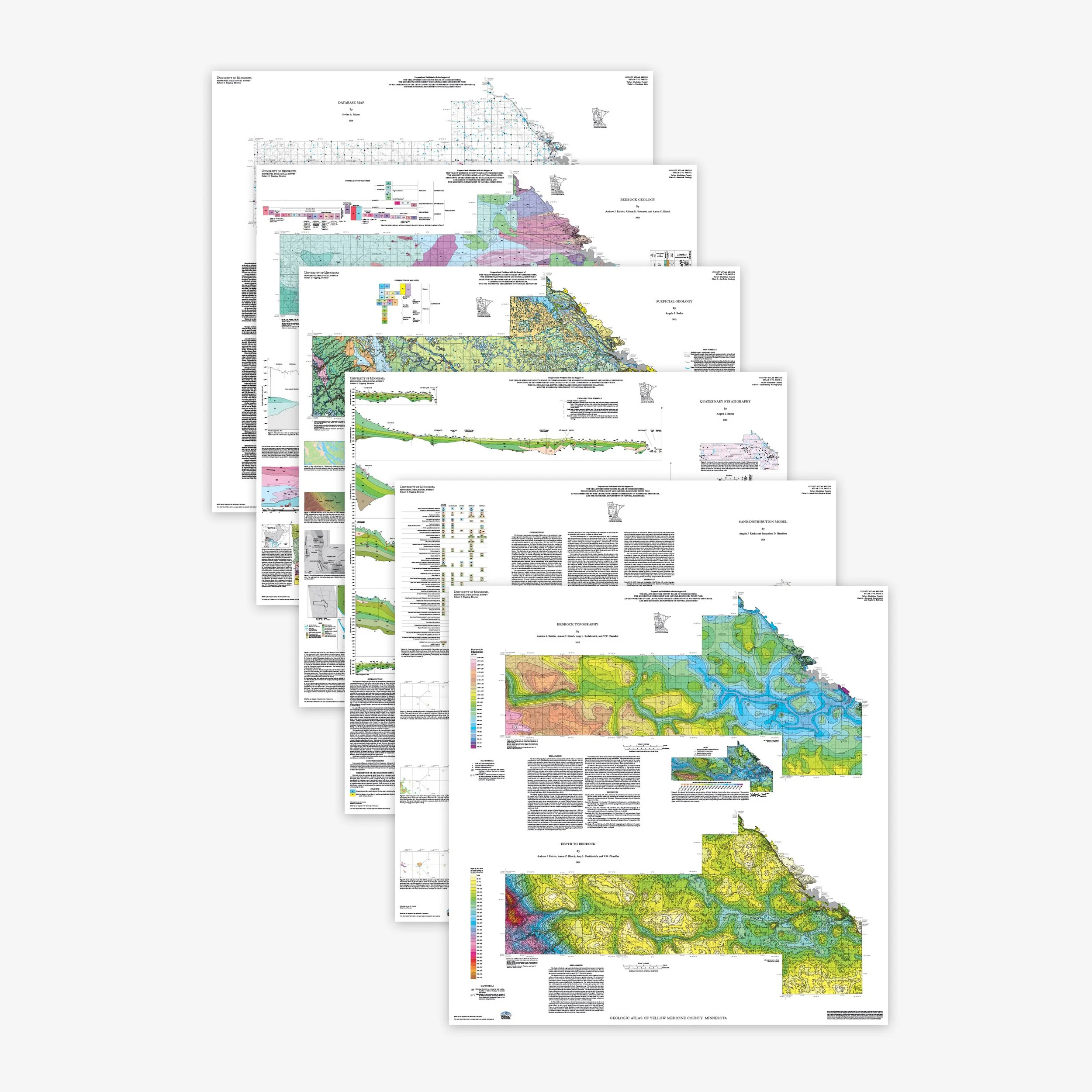 Image 1 of 7
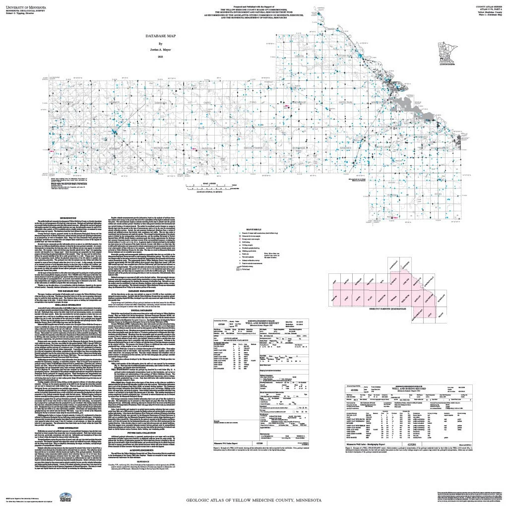 Image 2 of 7
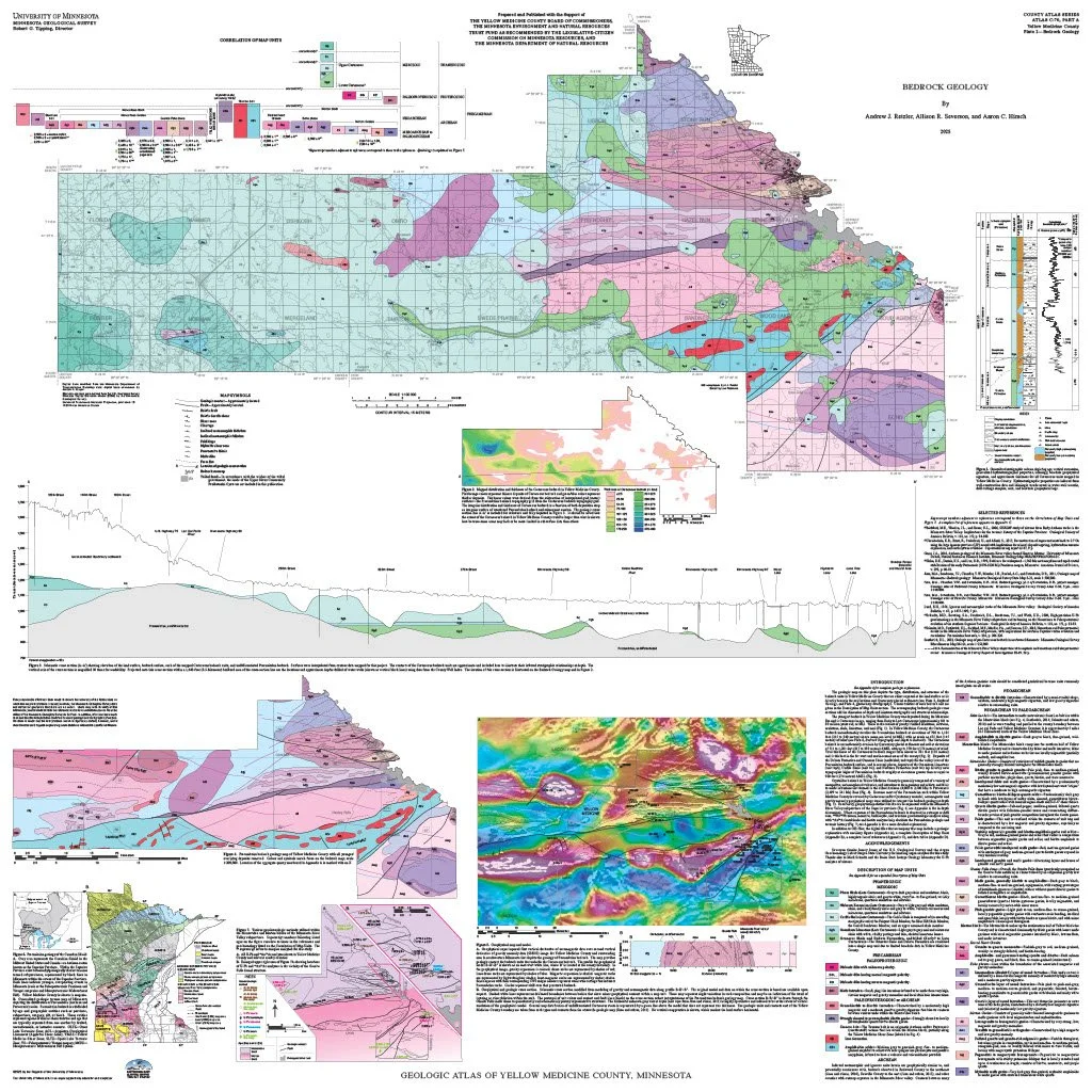 Image 3 of 7
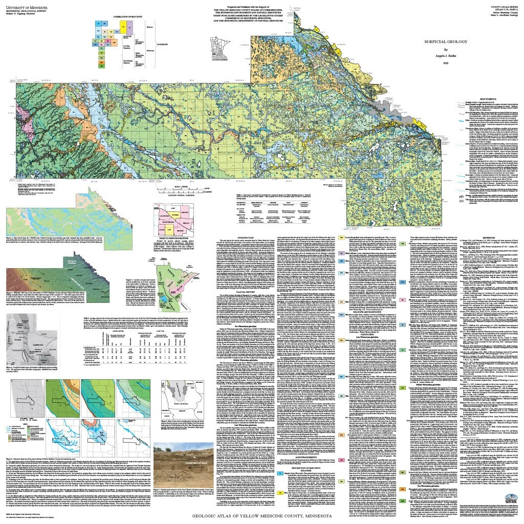 Image 4 of 7
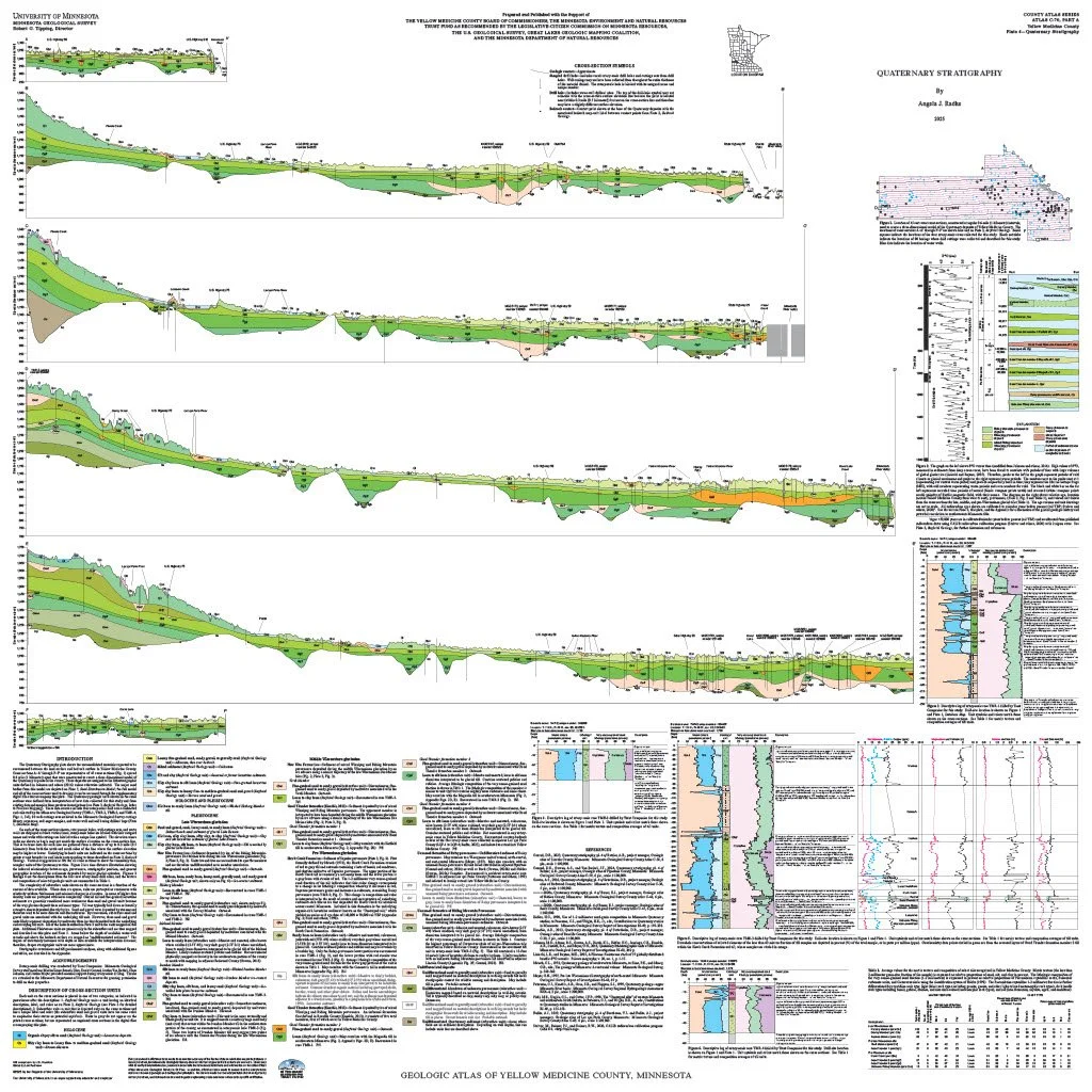 Image 5 of 7
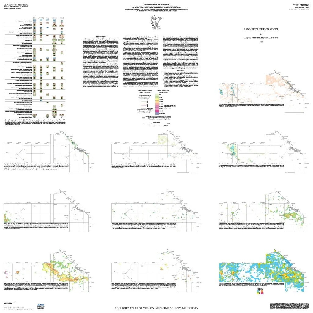 Image 6 of 7
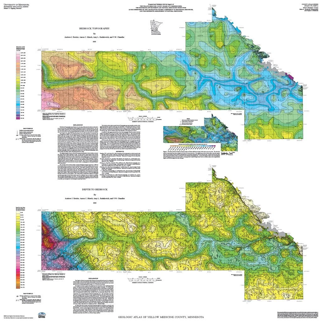 Image 7 of 7